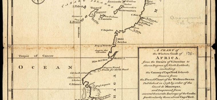
Carta náutica (24×19 cm)
Pertenece a la obra ‘A new general collection of voyages and travels’, bajo el nombre ‘A chart of the western coast of Africa, from the Straits of Gibraltar to eleven degrees of north latitude : including the Canary & Cape Verd Islands’, correspondiente con el Chart 1 Vol. 1, número XI. Aparecen las islas de Madeira y el archipiélago de las Islas Canarias así como una corta franja de la costa africana.
| Autor: | Kitchin, Thomas; Astley, Thomas; Green, John |
|---|---|
| Año: | 1738 |
| Fuente: | Boston Public Library . Norman B. Leventhal Map Center. Identifier: 06_01_007146 / Call #: G8735 1745 C53x / Barcode: 39999059029957. |


